Permit drawing terms, explained

Plot plan vs. site plan: what is the difference?

For many home permits, the terms mean the same basic drawing. A plot plan often focuses on the lot and project location. A site plan can include broader details. Your permit checklist decides what belongs on the sheet.

Check my address free

Check eligible fence, shed, and pool projects in Austin, Round Rock, Cedar Park, Georgetown, Pflugerville, and San Antonio.

One sheet, many names
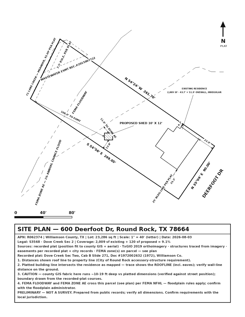
Example residential permit plan showing the lot, existing structures, dimensions, easements, and proposed work
The required details matter more than the label at the top.

Usually shared

Lot, structures, and project

Both drawings can show property lines, buildings, proposed work, dimensions, north, and scale.

Possible difference

A site plan can be broader

Access, utilities, drainage, grading, parking, or landscaping may enter a wider site review.

Never assume

Neither name proves a survey

A document becomes surveying work through its professional scope, not through the words plot plan or site plan.

Side-by-side

The terms overlap. The review scope can change.

Treat these as common patterns, not fixed legal definitions. An office can use either name for its required permit drawing.

Parcel-focused

Plot plan

Site-focused

Site plan

Main focus
The parcel, structures, setbacks, and proposed project
The same core drawing, sometimes with wider site systems
Common permit use
Fence, shed, pool, addition, or other simple residential work
Residential or commercial review with more site conditions
Possible extra detail
Easements, street, dimensions, and project ties
Parking, access, utilities, drainage, grading, or landscaping
Boundary certification
Not implied by the name
What controls
The reviewing office's checklist

What the document name can tell you

The name can suggest the reviewer's focus. A request for a plot plan often centers on the parcel and the proposed improvement. A request for a site plan may signal a wider review of how the property works. That clue helps you organize the sheet, but it does not replace the written requirements.

Start with the common base: property lines, existing structures, the proposed project, dimensions, north, and scale. Then add each item the office names. This method works even when two departments use different labels for a similar drawing.

What the document name cannot prove

The title alone cannot prove who prepared the drawing, how the boundary was located, or whether a professional certified it. It also cannot show that every permit requirement appears on the sheet. Those facts come from the drawing, its notes, its source records, and any signature or seal.

Ask a direct question when the instructions are unclear: does the office accept an applicant-prepared plan for this project? If the answer names a surveyor, engineer, architect, or another professional, follow that requirement before you spend time drafting.

Read the request in this order

Build to the checklist, not the document name.

A clear permit request usually tells you more than a generic definition. Read every attachment and note before preparing the drawing.

  1. 1

    Confirm the project

    Fence, shed, pool, addition, driveway, and grading reviews can ask for different details.

  2. 2

    List every required feature

    Copy the office's required labels, dimensions, setbacks, and supporting sheets into a checklist.

  3. 3

    Check the required author

    Look for words such as applicant-prepared, signed, sealed, certified, engineer, or surveyor.

  4. 4

    Resolve missing property facts

    Do not estimate a disputed line, unknown easement, or unverified structure location.

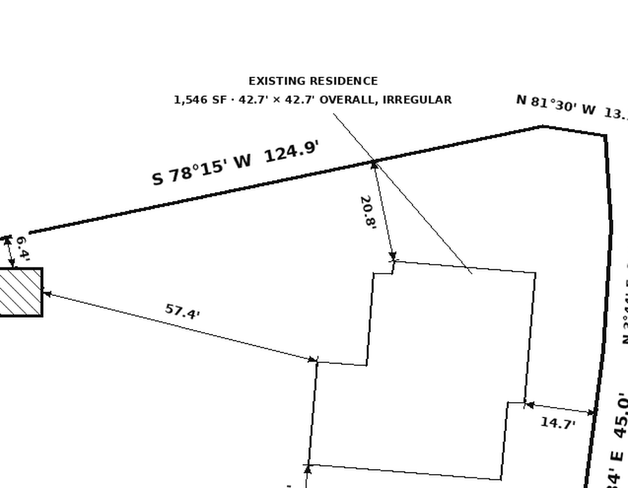
Permit drawing detail showing dimensions from proposed work to parcel lines
Project dimensions and property-line ties help reviewers check location and setbacks.

Turn the permit notes into a drawing checklist

Separate the request into four groups before you draw. Record the base property facts, the existing conditions, the proposed work, and the labels or dimensions the reviewer must verify. This makes missing items easier to find than reading the instructions again after the sheet is complete.

Property

Lot lines, dimensions, street names, easements, north, and drawing scale.

Existing

Buildings, driveways, fences, pools, sheds, and other features named by the office.

Proposed

Project size, location, distances to lot lines, and distances to nearby structures.

Review notes

Required labels, height or area facts, signatures, supporting sheets, and revision notes.

Include only facts you can support. Mark an uncertainty for follow-up instead of turning an estimate into a precise-looking dimension.

Review the finished sheet in two passes

First, compare the drawing with the permit checklist one line at a time. Confirm that every requested feature has a clear label and that each required dimension is readable. Then review the sheet as a map. Make sure the proposed work stands apart from existing conditions, related labels sit near the correct feature, and no note covers a dimension or property line.

Check the exported page too. A complete editor view can still become unclear if a label is too small or an edge is cropped. Keep the permit notes beside you during this last review. The document name should not distract from the facts the reviewer needs to find.

The boundary line

A plot plan is not automatically a survey.

A permit drawing can use a recorded plat, appraisal records, aerial imagery, owner measurements, or an existing survey as source material. That process does not locate or certify a boundary on the ground.

Hire a Texas registered professional land surveyor when a line or corner must be located, a dispute exists, a structure sits close to an uncertain line, or the reviewing office requires signed surveying work.

A recorded plat can describe a lot without confirming where every corner sits today. An appraisal map can help with orientation without serving as boundary evidence. Aerial imagery can show visible features, but roofs, trees, shadows, and image angle can hide the ground location. Treat each source according to what it can establish.

If your project depends on a precise boundary, do not solve that question by changing the title from site plan to plot plan. Pause the permit drawing and get the required boundary work first. The right professional can then provide reliable source information for the remaining plan.

Compare a site plan with a land survey

Where EasySitePlan fits

A preliminary plan for a supported permit.

EasySitePlan builds an editable preliminary permit sheet from public records and aerial imagery. You inspect the drawing, correct it, and submit your own permit package.

  • Free address and project eligibility check
  • Fence, shed, and pool projects only
  • Free editor and watermarked preview
  • $24 standard price for the clean PDF
  • Six current Texas service cities
  • Free redraws when you need corrections

Know the limits before you start.

EasySitePlan is not a survey, does not certify boundaries, does not provide engineering, does not submit permits, and does not guarantee approval.

Project examples

The same base sheet can answer different questions.

Permit view

Fence

Where does the fence run, how tall is it, and how far is it from streets, easements, or sight areas? A reviewer may need each fence segment labeled because one property can have several conditions. Show the proposed run separately from existing fencing so the scope stays clear.

Permit view

Shed

Where does the shed sit, what are its dimensions, and how far is it from lot lines and other structures? Show the proposed footprint and identify the structure as new. Do not let a roof symbol or aerial image make the location harder to read.

Permit view

Pool

Where is the pool, deck, and equipment, and how do they relate to lot lines, structures, easements, and barriers? Keep each proposed feature distinct. The drawing should help the reviewer connect the pool area with the other site conditions named in the checklist.

These are common review questions. Your exact requirements can differ by city, property, zoning, overlay, project, and permit type.

Texas wording example

One label can combine both terms.

Austin's fence guidance uses the phrase “Plot Plan Survey” and lists features to show. That wording is a useful reminder: read the stated content and author requirements instead of relying on a generic label.

Read Austin's current fence guidance

This example explains terminology only. EasySitePlan supports eligible fence, shed, and pool projects in its six listed cities.

Use the current instructions

Permit pages and checklists can change. Confirm that you have the current version for your address, project, and permit type. A sample drawing from another city can explain layout, but it cannot set your local requirements.

Read beyond the heading

Look for the required scale, dimensions, source documents, signatures, and supporting sheets. Also check whether the office gives separate instructions for corner lots, easements, overlays, or other property conditions.

Plot plan and site plan questions

Short answers before you draw

Is a plot plan the same as a site plan?

Often, yes. Many permit offices use both names for a scaled drawing of the lot, existing improvements, and proposed work. Some offices use site plan for a broader drawing that also covers access, utilities, drainage, landscaping, or other review items. The local checklist controls.

Is a plot plan a land survey?

Not automatically. A permit plot plan can be prepared from records, measurements, and aerial imagery. A boundary survey is professional surveying work. It locates boundaries using records and field evidence. Hire a Texas registered professional land surveyor when a boundary must be located, marked, or certified.

Can I draw my own plot plan for a permit?

Sometimes. Some offices accept an applicant-prepared plan for a simple residential project. Others require a professional drawing, survey, or extra technical sheets. Check the current instructions for your property and project before you draw.

What should a residential plot plan show?

A basic permit plan often shows property lines, lot dimensions, existing structures, the proposed project, distances to property lines, street names, easements, a north arrow, and scale. Your office may request additional items.

When is a site plan more detailed than a plot plan?

A site plan can become more detailed when the review covers parking, driveways, utilities, grading, drainage, fire access, landscaping, or several proposed improvements. The name does not set the scope. The permit checklist does.

What does EasySitePlan cost?

The address check, editor, local checklist, redraws, and watermarked preview are free. The standard one-time price for the clean PDF is $24.